Active AlertsAttoyac, TX
For your protection move to an interior room on the lowest floor of abuilding.
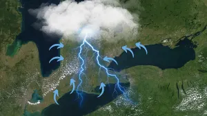
SVRSHVThe National Weather Service in Shreveport has issued a* Severe Thunderstorm Warning for...Northwestern Sabine Parish in northwestern Louisiana...Southeastern Nacogdoches County in eastern Texas...Southeastern Shelby County in eastern Texas...East central Angelina County in eastern Texas...San Augustine County in eastern Texas...Sabine County in eastern Texas...* Until 745 PM CDT.* At 651 PM CDT, severe thunderstorms were located along a lineextending from near Patroon to 6 miles east of Bland Lake to nearSan Augustine to 6 miles west of Macune to near Woden, moving southat 15 mph.HAZARD...60 mph wind gusts and quarter size hail.SOURCE...Radar indicated.IMPACT...Hail damage to vehicles is expected. Expect wind damageto roofs, siding, and trees.* Locations impacted include...Milam, San Augustine, Hemphill, Pineland, Rosevine, Patroon,Macune, Etoile, Huxley, Noble, Broaddus, Hurstown, Sexton, Bronson,McElroy, Yellowpine, Toledo Bend Reservoir North, Jordans Store,and Chinaquapin.
SEVERE THUNDERSTORM WATCH 367 REMAINS VALID UNTIL 9 PM CDT THISEVENING FOR THE FOLLOWING AREASIN LOUISIANA THIS WATCH INCLUDES 8 PARISHESIN NORTHWEST LOUISIANABIENVILLE BOSSIER CADDODE SOTO NATCHITOCHES RED RIVERSABINE WEBSTERIN TEXAS THIS WATCH INCLUDES 14 COUNTIESIN NORTHEAST TEXASANGELINA CHEROKEE GREGGHARRISON MARION NACOGDOCHESPANOLA RUSK SABINESAN AUGUSTINE SHELBY SMITHUPSHUR WOODTHIS INCLUDES THE CITIES OF ARCADIA, BIG SANDY, BOSSIER CITY,CARTHAGE, CENTER, COUSHATTA, GIBSLAND, GILMER, HAWKINS, HEMPHILL,HENDERSON, JACKSONVILLE, JEFFERSON, LOGANSPORT, LONGVIEW, LUFKIN,MANSFIELD, MANY, MARSHALL, MARTIN, MINDEN, MINEOLA, NACOGDOCHES,NATCHITOCHES, PINELAND, PLEASANT HILL, QUITMAN, RINGGOLD, RUSK,SAN AUGUSTINE, SHREVEPORT, SPRINGHILL, STONEWALL, TYLER,WINNSBORO, AND ZWOLLE.
Do not drive cars through flooded areas.The next statement will be issued Sunday morning at 1000 AM CDT.
...The Flood Warning is extended for the following rivers in Texas...Attoyac Bayou Near Chireno affecting San Augustine, Rusk,Nacogdoches and Shelby Counties.For the Attoyac Bayou...including Chireno...Minor flooding isforecast.* WHAT...Minor flooding is forecast.* WHERE...Attoyac Bayou near Chireno.* WHEN...Until Monday afternoon.* IMPACTS...At 14.0 feet, Expect lowland flooding for the nextseveral days of the heavily wooded floodplain. Ranchers that havecattle and equipment near the river should move them to higherground.* ADDITIONAL DETAILS...- At 9:30 AM CDT Saturday the stage was 12.6 feet.- Bankfull stage is 14.0 feet.- Forecast...The river is expected to rise above flood stageearly tomorrow afternoon to a crest of 14.1 feet tomorrowevening. It will then fall below flood stage late tomorrowevening.- Flood stage is 14.0 feet.