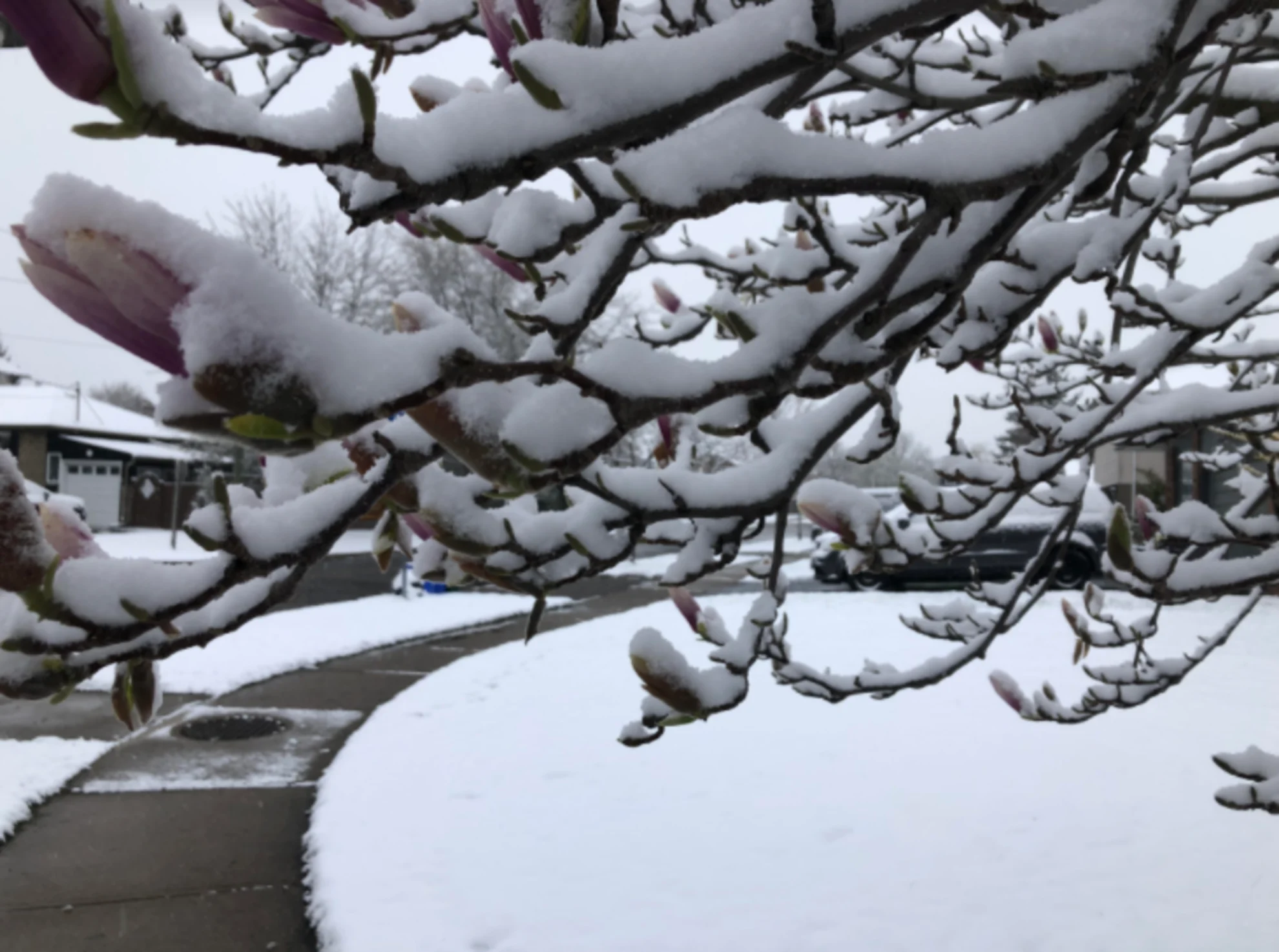
Late snowfall puts a 'freeze' on summer for these provinces
It may be the end of May, but Mother Nature is putting a 'freeze' to the start of summer for many Canadians this week
While many Canadians are basking in an early taste of summer as we head into the final days of May, some folks are left getting the cold shoulder.
High humidity across southern Ontario, Quebec, and New Brunswick has temperatures feeling like the high-twenties to low-thirties everyone has come to expect with summer weather. Thunderstorm threats from these conditions lend themselves further to the summer preview this week.
However, along the boundary of this humidity is a sharp contrast, with chilly temperatures, rain, and... snow!
Alpine snow descends over B.C. and Alberta
A trough of cool air has allowed for below-seasonal temperatures to spread across Western Canada. With these cooler temperatures in place, it will only take a weak system to descend from the North to bring snowfall to the Rocky Mountains and British Columbia's coastal mountain ranges this week.
SEE ALSO: Multiple homes destroyed in Fort Nelson, B.C., wildfire, officials say
Special alerts are in place along the Coquihalla Highway, Allison Pass, Okanagan Connector, and Kootenay Pass in B.C. as 2-4 cm of snow could fall over the mountain passes and impact travel.
There is also a small window for snow to fall over southern Vancouver Island with this system.

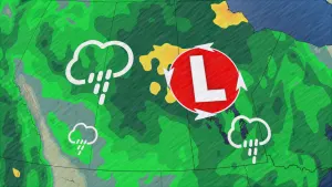
Rain and snow stall over northwestern Ontario
A moisture-laden low pressure system will stall over northwestern Ontario through Wednesday. This will bring some much-needed rain to the northern forests amid rising concerns about an active wildfire season in northern Ontario and across Canada.
A full 24-hours of persistent rain will thoroughly dampen the ground. 50-75 mm of rain is possible throughout the Rainy River district, as well as the eastern Kenora district and Thunder Bay area. Environment and Climate Change Canada issued a rainfall warning for the region on Tuesday morning.

However, by Wednesday, cold air will begin to wrap around the low, bringing in the chance for wet snow to fall north of Dryden and over the Red Lake region. While locals in this region are no strangers to a May snowfall, it is unusual to see snow this late in the month.
DON'T MISS: Ontario researchers examine why wildfires and tornadoes have tangly relationship
Temperature fluctuations will make it hard to forecast exactly how much snow may accumulate, but current models suggest upwards of 10 cm is possible. Luckily, the wet snow should stay north of the Trans Canada Highway.

Wintry weather persists in Labrador
Moving farther north into Labrador, a low will track in some light snow across most of the province through Wednesday.
This will not be the end of the snowy weather, though, as a stronger low pressure system will move in late Thursday. Temperatures will be hovering around the freezing mark, opening the province up for a chance to see some wet snow fall through Friday.
The highest snowfall will be to the north, around Nain. Folks here, though, are accustomed to seeing June snowfalls, so this is not going to be anything out of the ordinary for them.

While this late-May snow may not be entirely welcome by everyone, it is needed to help these wildfire-prone areas as the 2024 wildfire season continues across Canada.
Stay with The Weather Network for the latest on your weather across Canada.