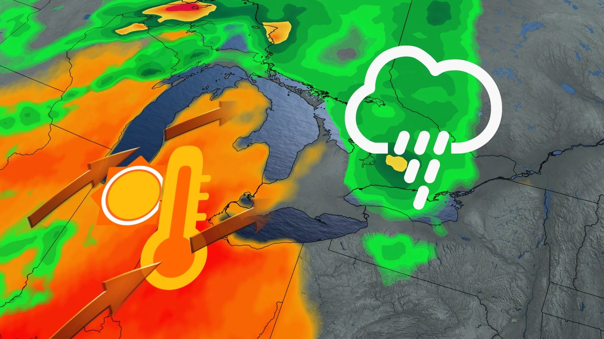
Ontario to jump into summer-like weather as temperatures heat up fast
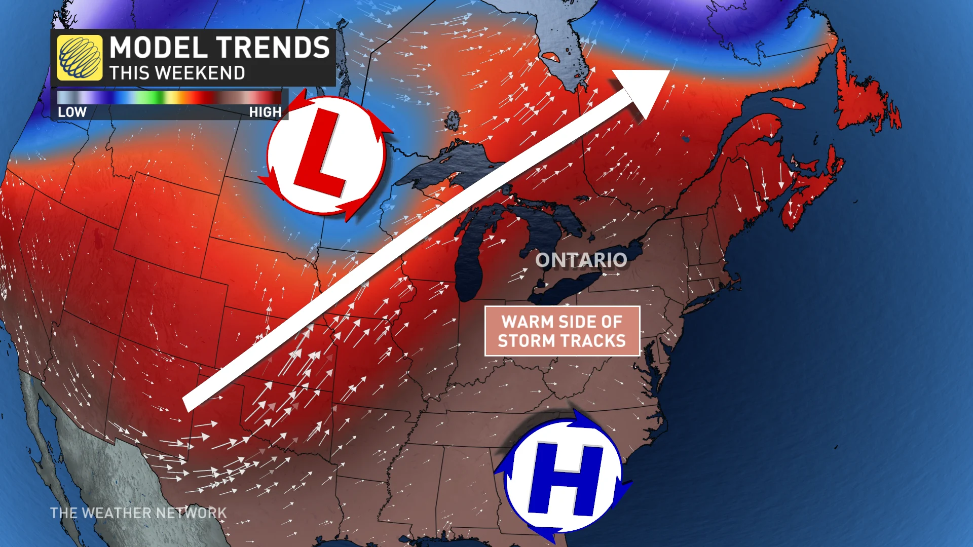
After days with a frost-and-freeze threat, temperatures will be heating up in southern Ontario this weekend. An active storm track will drag both warmth and moisture into the region, introducing a summer-like humidex
Spring can be known as the most volatile transition season, as winter refuses to let go without a fight. Across Ontario, a shot of arctic air brought a widespread freeze into Thursday morning, threatening orchards and blossoms that have already bloomed.
DON’T MISS: The '3Cs' you need to know to protect your plants from frost
Then in true spring fashion, the battle continues, as much warmer air floods into the region in time for the weekend.
Well-above-seasonal temperatures will dominate through Sunday, with even a humidex in the forecast. For some regions across the southwest, things could be feeling like 30 by Sunday. Yes, we said 30.
From frost to feels like 30 -- talk about a roller-coaster. Here's what to plan for.
Thursday: Chance of frost before warm-up moves in
Temperatures will rise just above the freezing mark in northern sections of Ontario on Thursday, remaining in the cool single digits across the southern end.
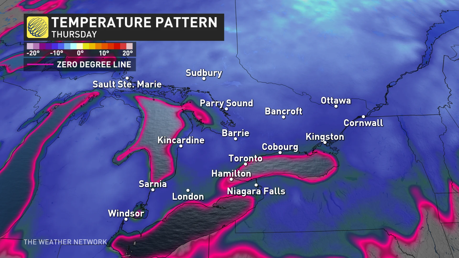
Overnight temperatures will range from 1°C to as cold as -5°C in central Ontario on Thursday morning.
Frost is expected as a result, so, if you have begun planting already, it will be necessary to protect them beforehand.
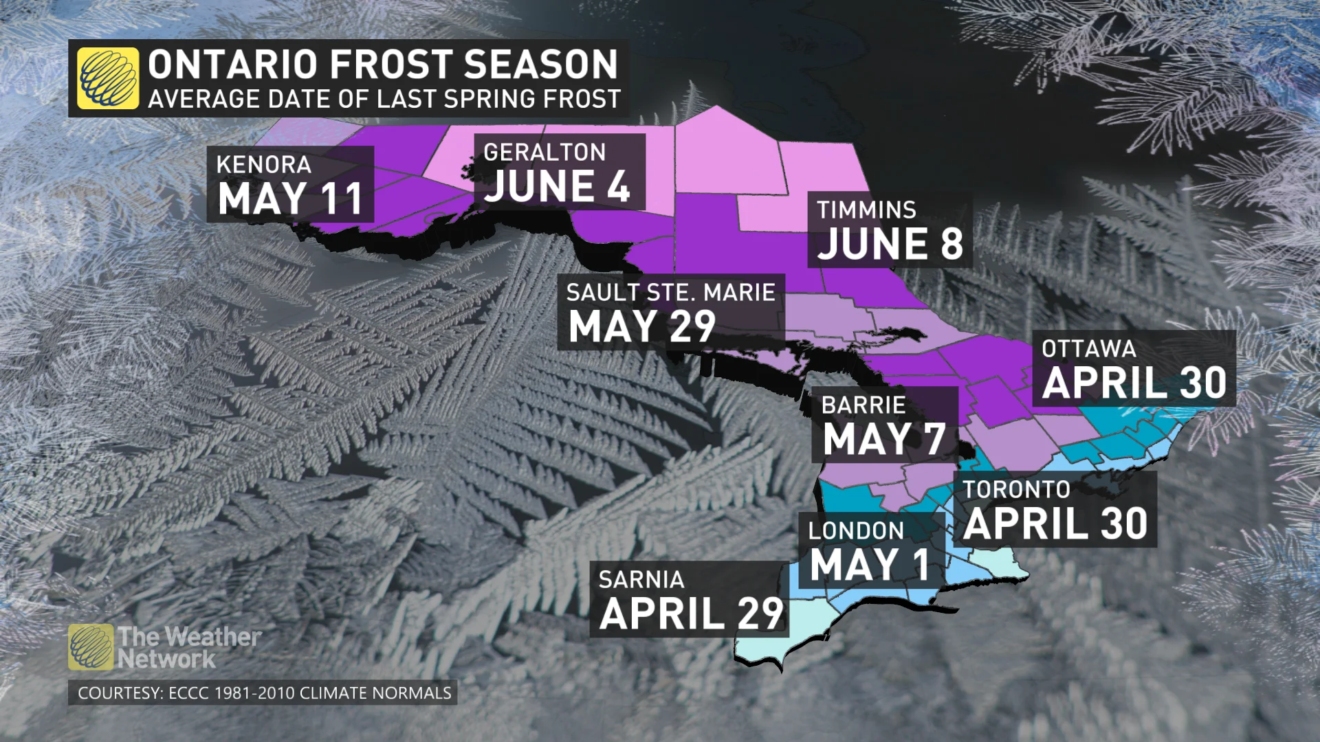
The average, last-frost date is around the end of April or the first week of May for southern Ontario. Those are just average dates, however, as below-freezing temperatures can occur right until the end of May.
Friday into the weekend: Much warmer weather returns, and we're talking humidex values
Temperatures will then start their uphill climb by the end of the week, with abundant sunshine splashing through the forecast on Friday.
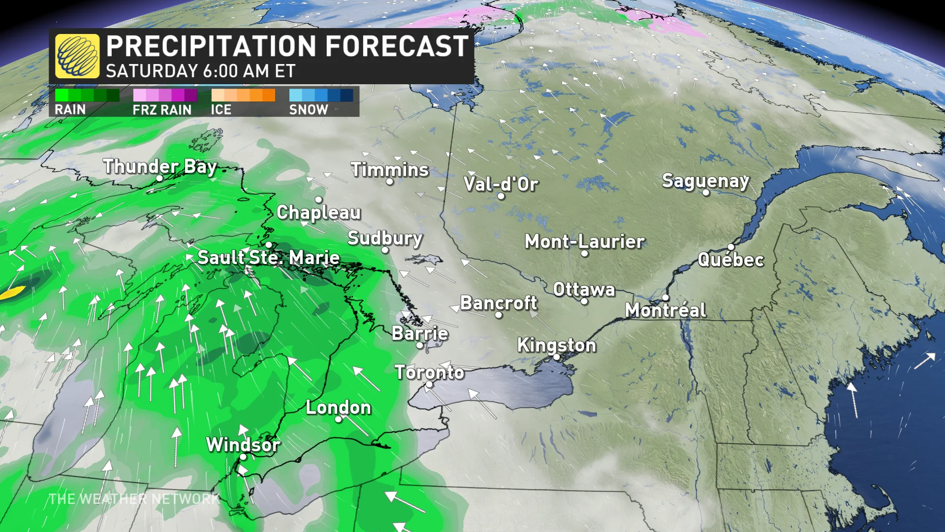
While temperatures will warm even further by Saturday, periods of rain, and possibly thunder, will take aim throughout the day.
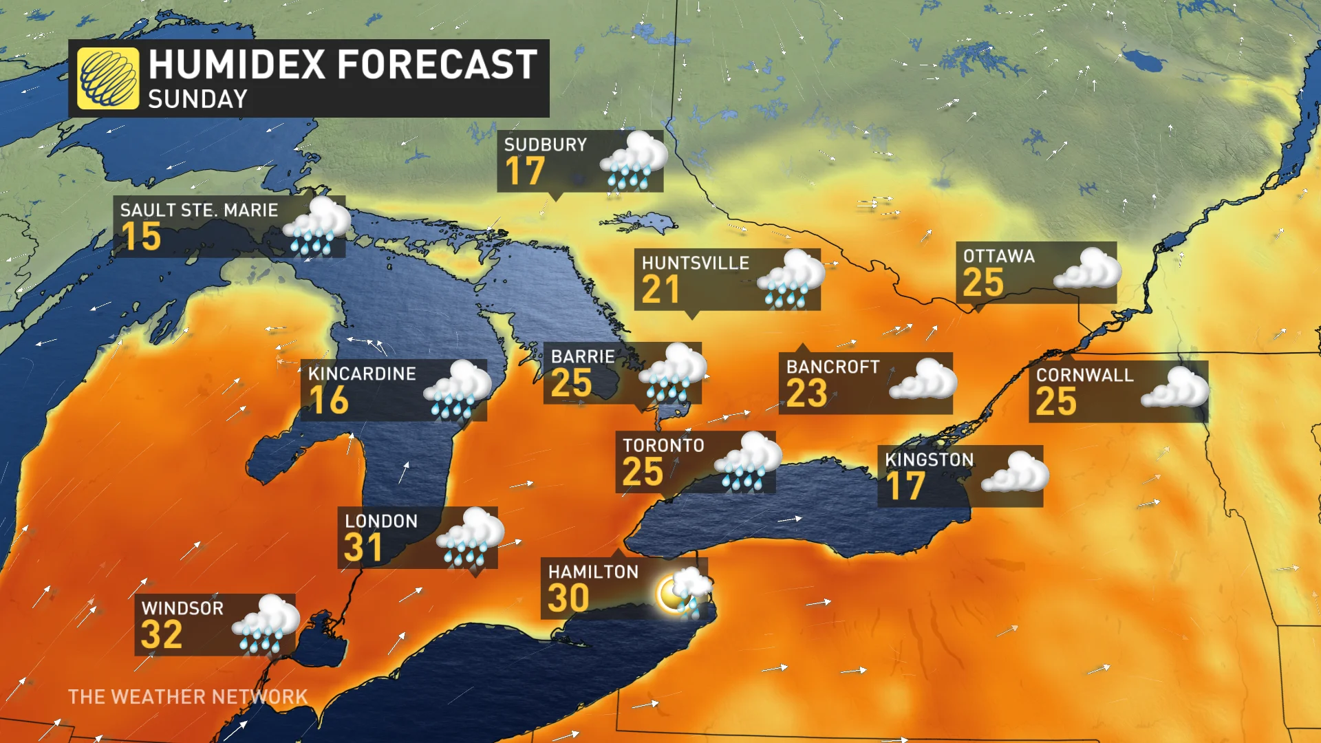
The showery weather will persist during Sunday, but also with the chances for the warmest day of the year so far.
Toronto's forecast of 21°C will be up against the 20.6°C day that was recorded back on March 13. Parts of the Greater Toronto Area (GTA), and regions to the north, however, could see temperatures hold in the upper teens with the cloudy conditions and chances for rain.
Meanwhile, Windsor's daytime high of 26°C is rivalling the 26.1°C that was felt on April 14. Humidity will be a factor, as well, with some areas including Hamilton and Windsor possibly feeling like 30 by Sunday afternoon.
The forecast is to remain above seasonal for the rest of April, and for the start of May, as well.
Although this is good news as we head into the last month of spring, historically, half of Mays typically do reach below freezing temperatures.
May 28, 1949 is the latest date that Pearson International Airport has seen a below 0°C temperature, so it's best not to pack away all of the warmer clothing just yet.
Stay with The Weather Network for the latest on your forecast across Ontario.