Nearly a month's worth of rain washes over parts of the Prairies this week
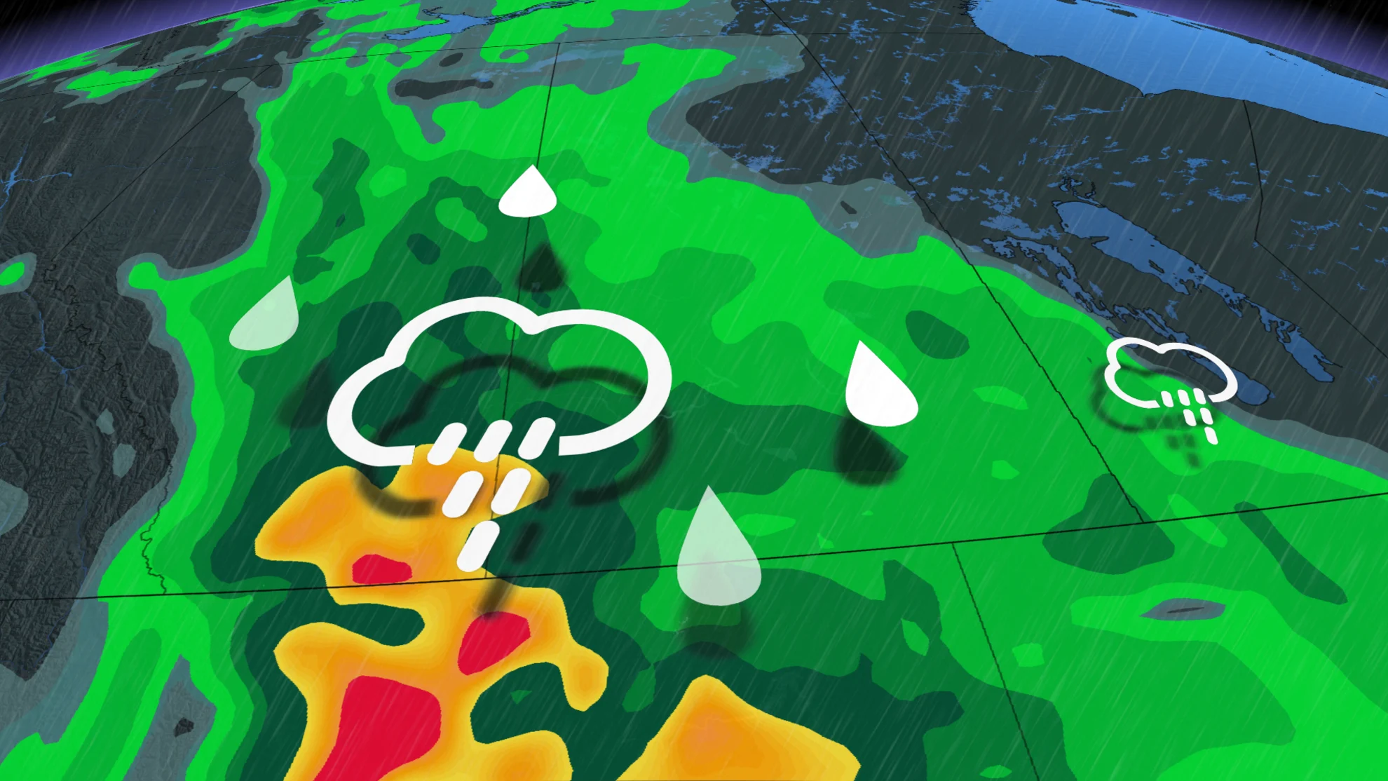
Heightened flood threat over parts of the Prairies as persistent heavy rain soaks the region this week. In some areas, as much as 100 mm could fall by Wednesday
Nearly a month's worth of rain will wash across parts of Alberta and Saskatchewan this week as a potent low-pressure system pushes through. This will help to ease the wildfire threat and drought conditions, though with the risk for some localized flooding and travel impacts in some of the harder-hit areas.
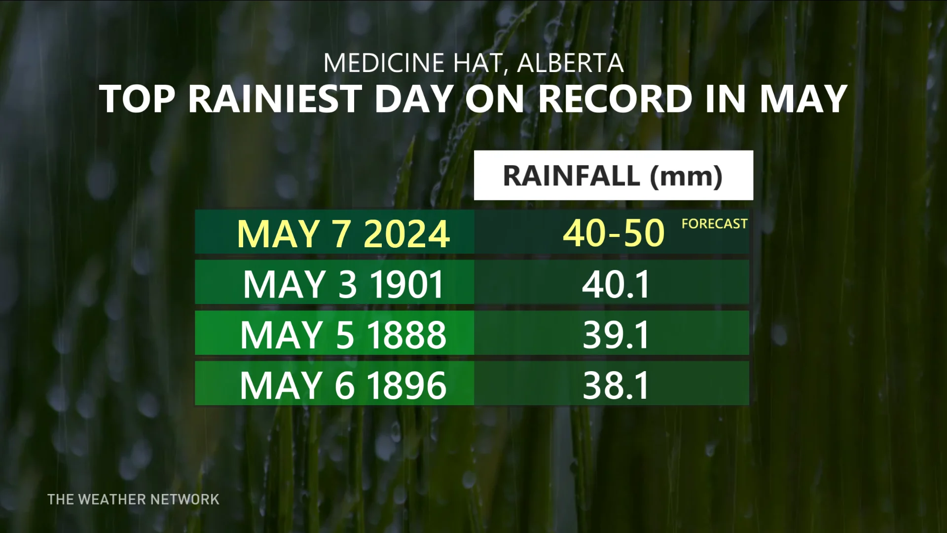
A 123-year-old, daily May rainfall record belonging to Medicine Hat, Alta., is in jeopardy of falling this week as the city faces an inundation of precipitation.
The rainfall amounts associated with this system will exceed the average May totals in just three days time. Some areas could see between 50-100 mm of rain by the time it wraps up Wednesday.
YOUR MAY OUTLOOK: Spring into summer or a stalling spring ahead, Canada?
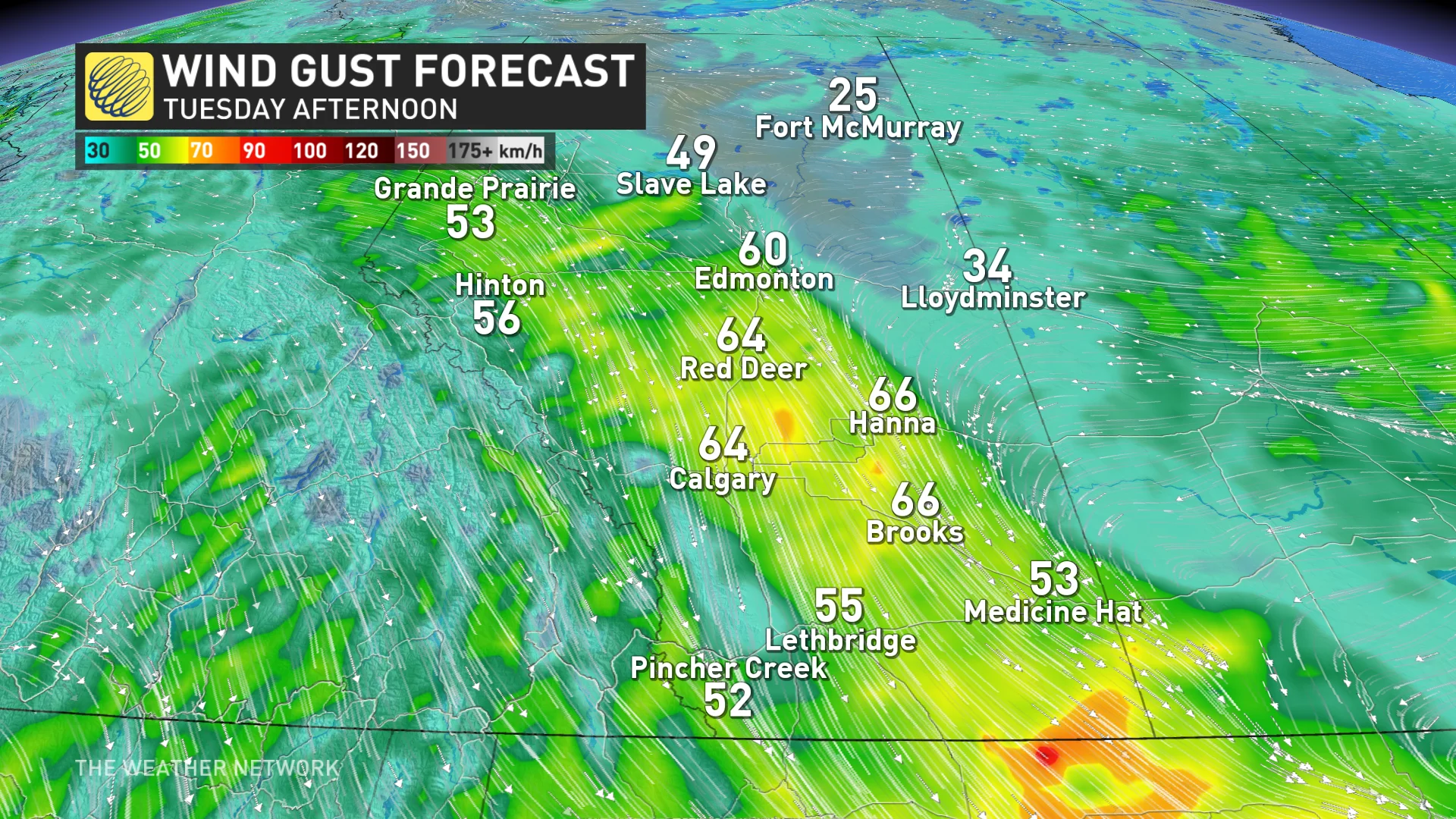
Winds between 50-70 km/h threaten parts of the region, as well, although they won't be as widespread of a risk. Regardless, residents are urged to plan ahead, and keep devices charged in case of some localized outages.
Tuesday into Wednesday: Heavy rain threatens some long-standing records
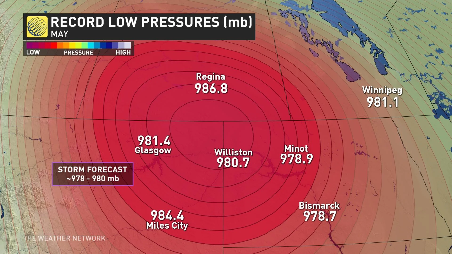
This low-pressure system is quite remarkable for this time of year. Its minimum central pressure is expected to drop near 980 millibars, which could set records in this region during the month of May.
Rainy conditions will continue through Tuesday, increasing in intensity during the day. Heavy downpours are forecast in eastern Alberta and western Saskatchewan. In fact, Tuesday’s rain could be record-breaking in Medicine Hat, Alta.
The Alberta community's rainfall totals are likely to hit 40-50 mm, potentially enough to exceed its largest, single-day rainfall event for the month of May (40.1 mm in 1901). If it is broken, it would be the rainiest May day for the community in 123 years.
Fortunately for farmers, the heaviest rain will fall over the western grasslands, likely avoiding a tough situation as we approach planting season east of Regina.
Persistent heavy rainfall could lead to flooding issues in vulnerable areas. Remember, never try to drive across a flooded roadway. It’s impossible to tell how deep the water is until it’s too late.
Wind gusts of 50-70 km/h are anticipated to accompany the heavy rainfall at times on Tuesday in Alberta and parts of southwestern Saskatchewan. The combination of gusty winds and rain-soaked soil could lead to isolated power outages.
SEE ALSO: May is here, along with all its Canadian weather extremes
Rain continues on into Wednesday, but will gradually ease throughout the morning.
All told, widespread rainfall totals 30-50 mm are in the forecast for much of the southern half of the Prairies. Locally higher totals of 50-100 mm are possible in southeastern Alberta and southwestern Saskatchewan.

The amounts will exceed the average May rainfall totals these areas receive in just three days.
"Heavy downpours can cause flash floods and water pooling on roads. Localized flooding in low-lying areas is possible," says Environment and Climate Change Canada (ECCC) in the rainfall warning issued for parts of Alberta. "Watch for possible washouts near rivers, creeks and culverts."

Stay with The Weather Network for your latest forecast across the Prairies.