Travellers beware: Multiple days of severe storm risk unfolds in the U.S.
As we approach the end of April, severe weather season is ramping up stateside, serving as a reminder for Canadians to be aware of what will be occurring more frequently north of the border as the country ditches the snow for thunderstorms.
As millions of Americans face the threat of severe thunderstorms and tornadoes this week, it serves as a safety reminder to Canadians that they can expect similar conditions leading up to and during the summer.
Severe weather has started to pick up in the southern U.S., with the National Weather Service's Storm Prediction Center (NWSSPC) highlighting the risks in its multi-day outlooks.
SEE ALSO: How severe weather alerts are issued, and potentially save lives
The multi-day, severe weather events are possible from Thursday to Saturday, with the highest chance of storms occurring Friday and Saturday. Among the hazards will be large hail, strong to damaging wind gusts and tornadoes.
Thursday to Saturday: Threats and risk areas will shift
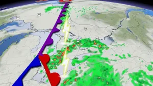
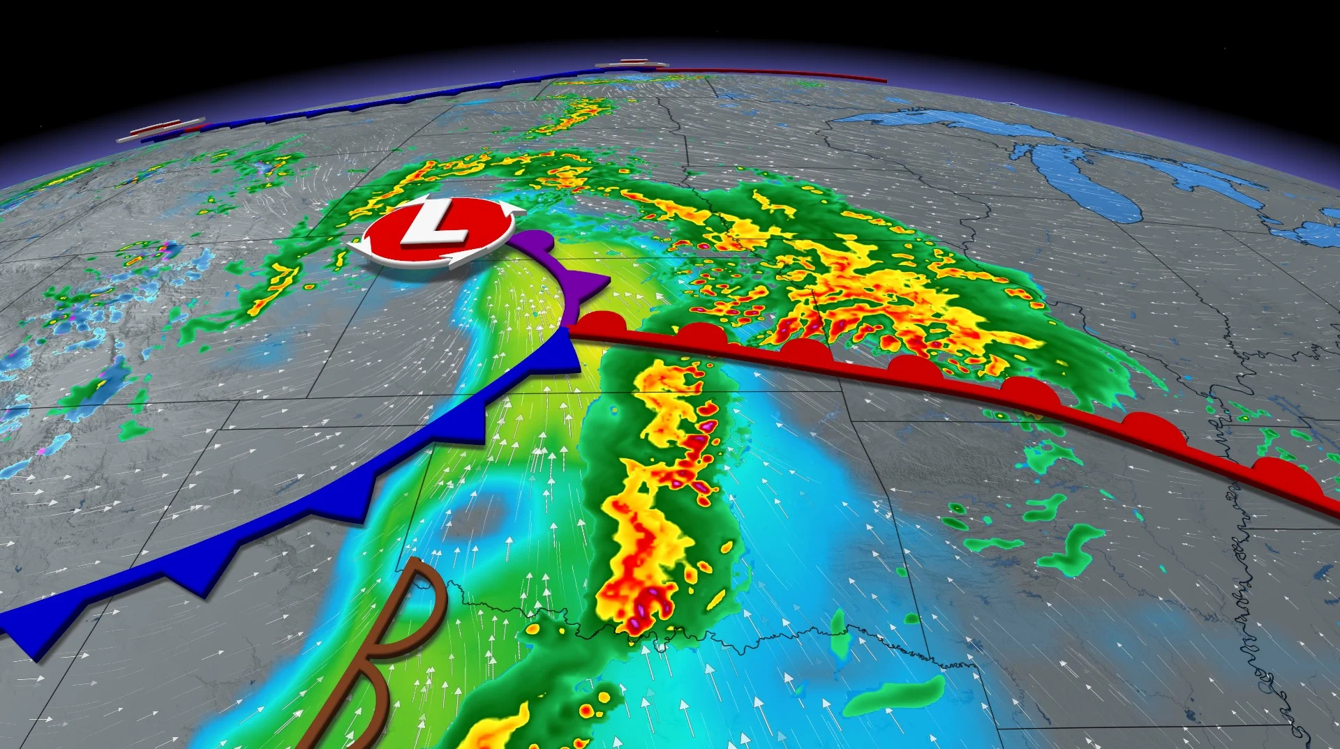
The two culprits for the prolonged threat of severe weather are separate low-pressure systems.
The threat increases on Thursday with moderate, deep-layer shear anticipated across much of the southern and central Plains. As a result, a few supercells with large hail and wind damage may occur. An isolated tornado threat could also develop.
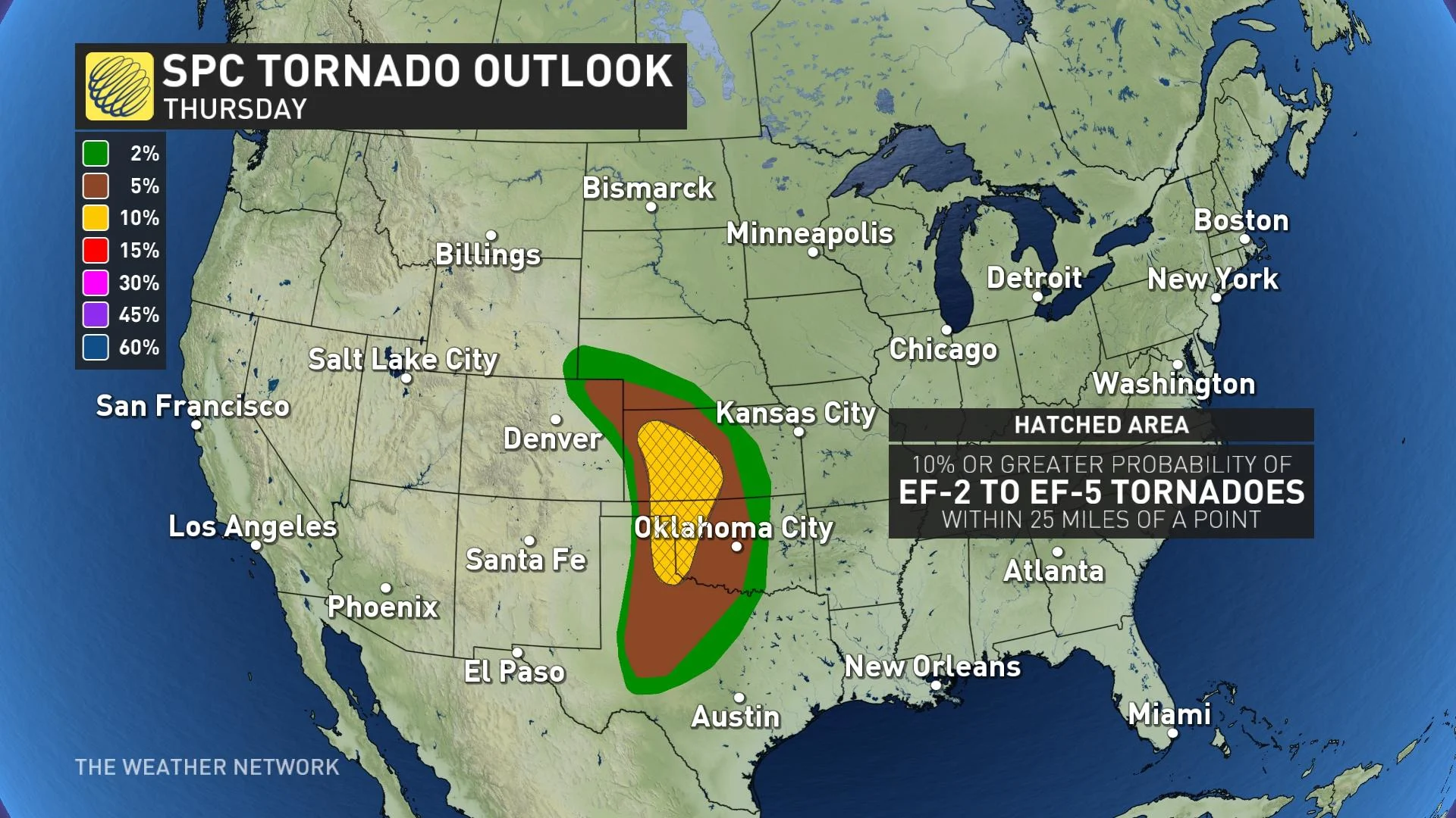
Major cities included in the risk on Thursday include Lubbock and Wichita Falls, Texas, and Salina, Kan.
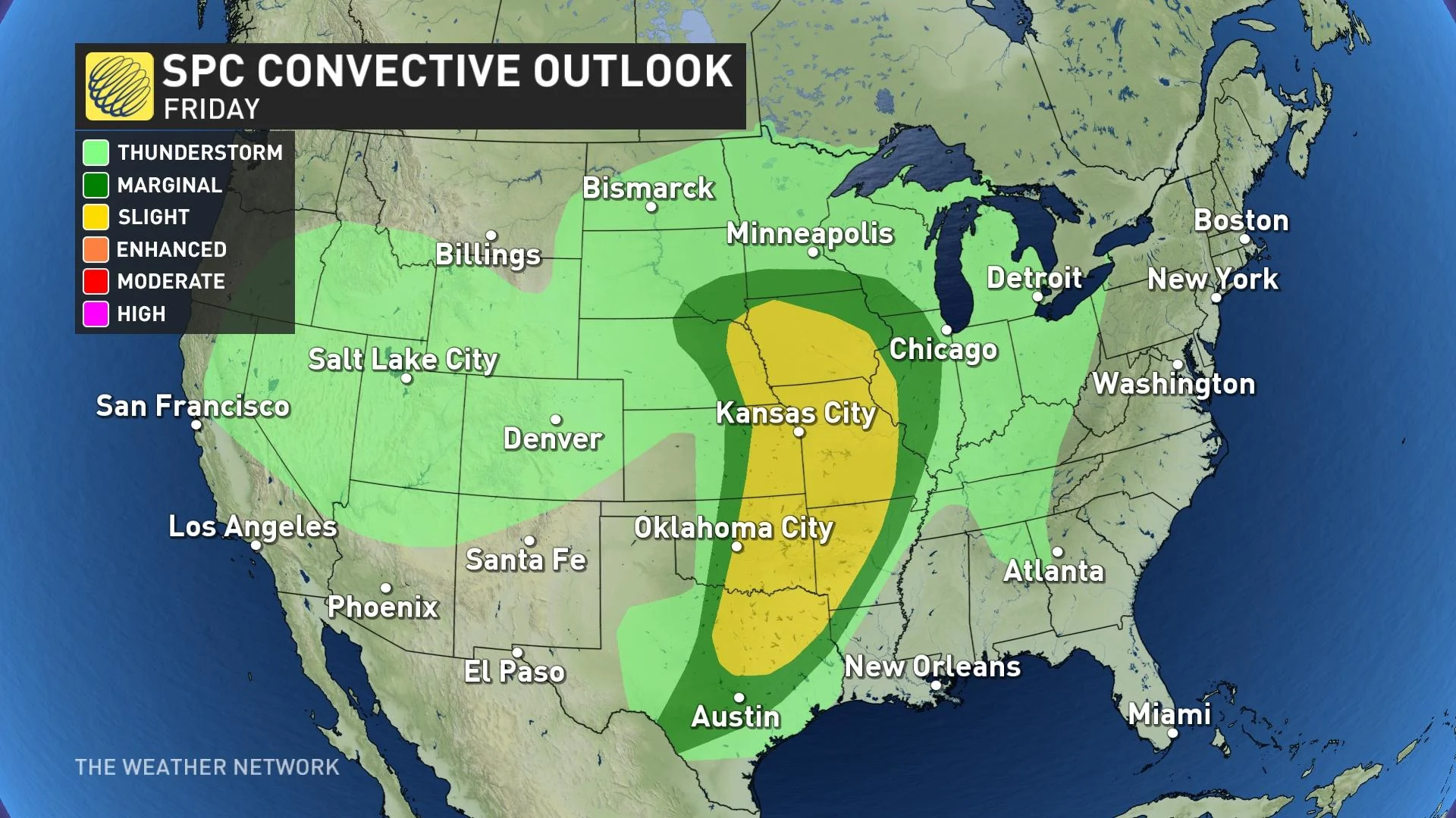
As we reach the end of the week, the NWSSPC says an upper-level trough will be accompanied by a moderate, deep-layer shear. Scattered, strong to severe storms are favoured with this setup, with the greatest threat stretching across northeast Texas, eastern Oklahoma, eastern Kansas and western Missouri. Large hail, wind damage and a few tornadoes will be possible in the afternoon and evening.
Dallas and Fort Worth, Texas, Oklahoma City, Okla., and Kansas City, Mo., will be the major U.S. cities under the risk of severe weather on Friday.
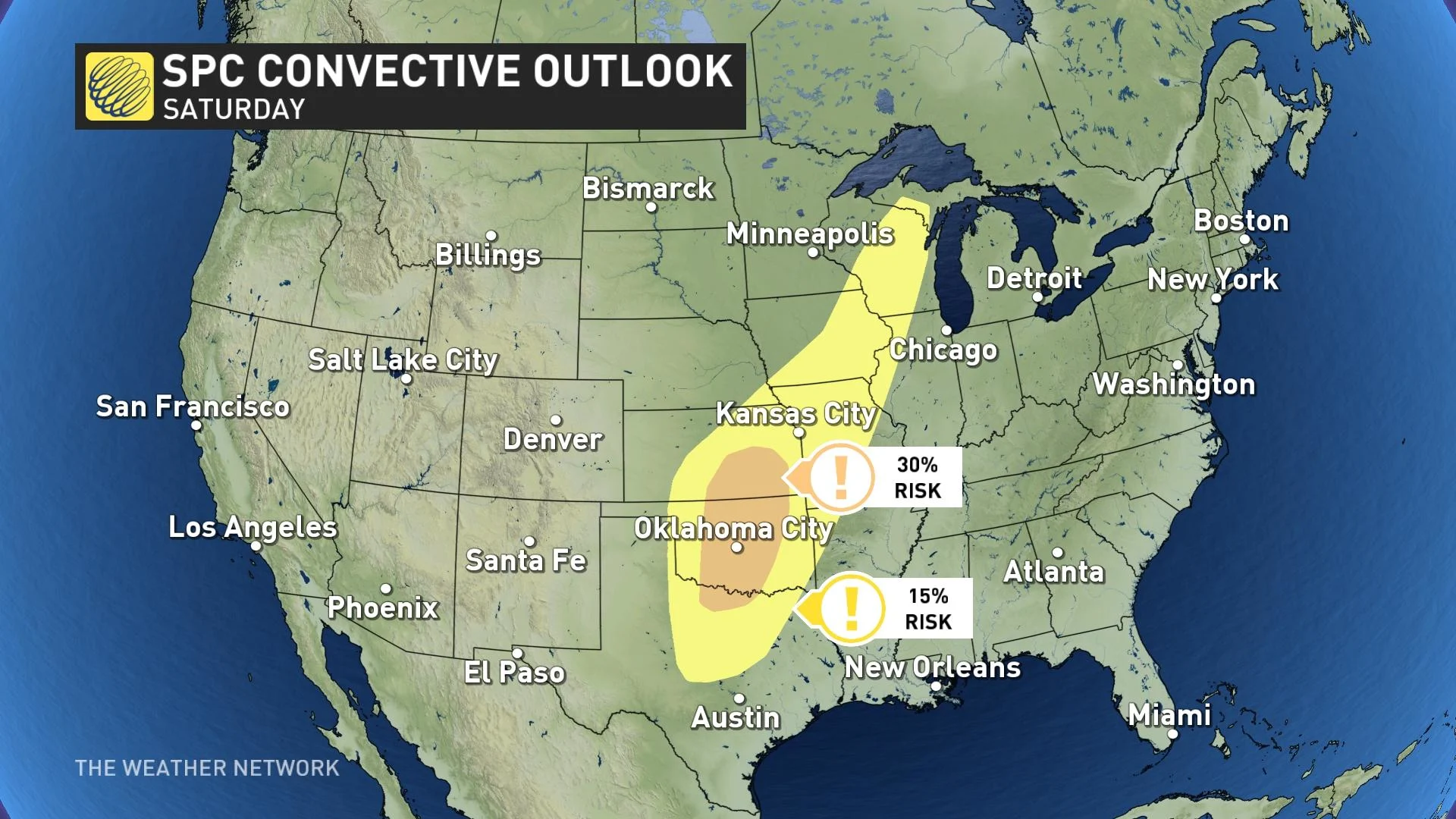
On Saturday, an upper-level trough is anticipated move into the southern and central Rockies.
As temperatures rise during the day, thunderstorms are forecast to develop from parts of north Texas into Oklahoma and southern Kansas. Moderate, deep-layer shear over an unstable air mass should aid in fostering scattered, strong to severe storms. Mesocyclone convective system (MCS) development may occur in parts of the warm sector on Saturday evening.
For Saturday's chance, Dallas and Fort Worth, Texas, and Oklahoma City, Okla., will be the major U.S. centres that could see storms develop.
Once the systems move through the southern U.S., they will track into southern Ontario for the weekend and early next week, but won't be as potent and won't pose a risk for severe weather.
Still, Canadians should pay attention to what's transpiring stateside and become weather-aware before the time comes for severe storms.